Introduction
 WEATHER ALERT!
You are a reporter working for a local television station in Cairns.On the evening news, we need for you to report on a tropical depression that is approaching the coast. Although this disturbance is not yet classified as a tropical cyclone, you will need to inform the public on the developing weather event.
You will be required to report to the public on the following items of interest:
*What is the energy source of a tropical cyclone and how do they occur?
*What are the four stages of development of a tropical cyclone?
*What impact will the cyclone have on the people and the environment in the area?
*How and When can people prepare for an oncoming cyclone?
*After/during the cyclone, what other weather events can be expected? eg. storm surge, flooding
Task
As a Television reporter your job is to research facts, write a report and present it to the Australian public.
To complete this project you are required to:
Task 1. Use the internet to help you research the websites given to you on tropical cyclones and write a report including the information you have gathered from answering the questions
Task 2. Present a 3-5 minute "News bulletin" to the class on your report. You should take on the role as a News presenter and you may use pictures or diagrams to assist you.
Questions:
1.What is the energy source of the tropical cyclone?
2.What are the four stages of development of a tropical cyclone?
3.Are tropical cyclones the same as hurricanes? Explain.
4.Do all tropical cyclones have an eye?
5.What type of devastation is caused to Earth's surface?(environmental and to people)
6.What type of warnings do people get if a cyclone is approaching? How do we know how severe it will be?
7.What types of plans are put into place to help people affected by cyclones?
8. Are there any other weather events that can occur when a cyclone hits that the public need to be aware of?
Process
There are five steps that you need to follow, but before you do read the evaluation.
1.You will be working with a partner. One person will take on the role of the news reporter, the other person will be the Meteorologist or cyclone expert. In the case of an odd amount of students, there may be the need for a group of three.
2. Use the websites given to you to research the topic of tropical cyclones and answer the questions.
3.Write a News report on your findings.
4.Read the evaluation again to make sure you know exactly what you will be assessed on.
5.Present a news report to the class (3-5mins). You can use pictures and diagrams. The news report will be filmed.
Cairns Regional Council Information for Residents
Preparing for a Cyclone (click to view brochure)
Storm Tide Evacuation Guide (click to view)
Useful websites for researching:
Information about Cyclones
This website has facts to explain cyclones, how they form, how they get its energy, when and where cyclones occur, cyclone predictions and warnings:
http://www.metoffice.gov.uk/weather/tropicalcyclone/facts
This website has facts about Tropical Cyclone Warning Services:
http://www.bom.gov.au/cyclone/about/warnings/
This website has facts about The Life Cycle of a Tropical Cyclone:
http://www.bom.gov.au/lam/Students_Teachers/cycmod.shtml
This website has facts on cyclone formation, stages and movement:
http://earthsci.org/processes/weather/cyclone/cyclone.html
This website contains a video that has information about how cyclones are measured. (categories)
http://www.bom.gov.au/cyclone/about/intensity.shtml
Cyclones and Hurricanes
This website has facts about cyclones, hurricanes and typhoons:
http://www.kidcyber.com.au/cyclones-and-tornadoes
This website has facts about how cyclones/hurricanes work and what they do:
https://spaceplace.nasa.gov/hurricanes/en/
Preparing for a cyclone
This website has facts about Surviving Cyclones: Preparation and Safety Procedures:
http://reg.bom.gov.au/cyclone/about/checklist.shtml
This website has facts about warnings and how to prepare for a cyclone:
https://getready.qld.gov.au/natural-disasters/cyclones/
What to do before, during and after
http://www.weatherzone.com.au/edu/cyclone/images/IG_CyclonePrep3_East_PDF.pdf
Other weather events
This website has facts about flooding.
http://eschooltoday.com/natural-disasters/floods/what-is-a-flood.html
This website has information about storm surges.
http://www.bom.gov.au/cyclone/about/stormsurge.shtml
Safety after a cyclone
http://www.healthdirect.gov.au/floods-and-cyclones

Evaluation
You will be evaluated on the following areas:
Assessment descriptor:
1. Ability to work with a partner
2. Ability to research websites and answer the questions given
3. Written News report
4. Oral presentation of News report to class
You will receive written feedback about your project!
Conclusion
Congratulations!
You have successfully completed your job as a reporter and informed the general public of your research on the tropical cyclone in North Queensland.
In doing so, you are now able to understand how tropical cyclones occur and the effects and damage that cyclones can cause to people and our environment. You have also developed your research skills and identified relevant information, especially the suggested questions.
Now that you're thinking like a reporter, you might want to look at the bigger picture, on a global level, and think about questions such as "Is climate change affecting tropical cyclones?".
Now you can share the information you have learnt with your family. You may teach them something new! Good luck.

Credits
Images
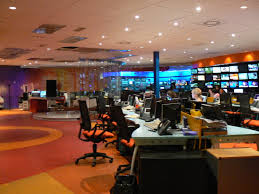
Newsroom
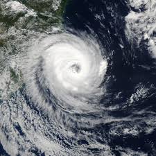
Cylcone
http://en.wikipedia.org/wiki/Cyclone_Catarina
Cyclone Devastation (boats)
http://www.telegraph.co.uk/news/earth/earthpicturegalleries/8300159/Cyc…;
Weather Report
http://article.wn.com/view/2007/02/03/Motorists_urged_to_steer_clear_of…
Teacher Page
AUSTRALIAN CURRICULUM
By the end of Year 5, students explain the characteristics of places in different locations at the national scale. They describe the interconnections between people, places and environments and identify the effect of these interconnections on the characteristics of places and environments. They describe the location of selected countries in relative terms and identify spatial distributions and simple patterns in the features of places and environments. They identify alternative views on how to respond to a geographical challenge and propose a response.
Students develop geographical questions to investigate and collect and record information from a range of sources to answer these questions. They represent data and the location of places and their characteristics in graphic forms, including large-scale and small-scale maps that use the cartographic conventions of border, scale, legend, title, and north point. Students interpret geographical data to identify spatial distributions, simple patterns and trends, infer relationships and draw conclusions. They present findings using geographical terminology in a range of communication forms. They propose action in response to a geographical challenge and identify the expected effects of their proposed action.
ACHGK028 The influence of the environment on the human characteristics of a place
ACHGK030 The impact of bushfires or floods on environments and communities, and how people can respond
ACHGS034 Collect and record relevant geographical data and information, using ethical protocols, from primary and secondary sources, for example, people, maps, plans, photographs, satellite images, statistical sources and reports
ACHGS038 Present findings and ideas in a range of communication forms, for example, written, oral, graphic, tabular, visual and maps; using geographical terminology and digital technologies as appropriate